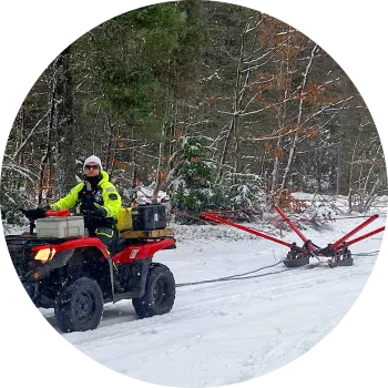
The SnowTEM delivers detailed mapping data in snow and ice. Suitable for permafrost, groundwater, sand, and gravel deposit mapping.
Conducting continuous measurements, capturing data reaching depths of 180 m (590 ft). The SnowTEM geoscanner is operated via an Android or iOS app.
Configuration options.
- 221 Transmitter coil – 2 x 2 m, 1 turn – Maximum depth of investigation 130 m. Less depth of investigation as 331 but slightly better resolution in shallow subsurface. 2 x 2 m coil enables access to narrower driving tracks.
- 331 Transmitter coil – 3 x 3 m, 1 turn – Depth of investigation 130 m. This system is optimized for a large depth of investigation and high resolution of shallow layers.
- 333 Transmitter coil – 3 x 3 m, 3 turns – Depth of investigation 180 m. System provides a large transmitter moment but with slightly less resolution in the shallow subsurface compared to the 331.